The Appalachian Trail, a legendary 2,190-mile trek through some of America’s most stunning landscapes, offers an array of breathtaking experiences.
This blog will guide you through the top 25 places to visit along the Appalachian Trail, highlighting the trail’s hidden treasures and stunning locations that make the hike an experience you won’t soon forget.

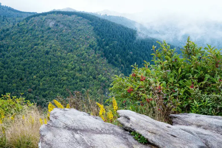
Wayah Bald offers an old stone observation tower with amazing panoramic views of the Nantahala National Forest.
It’s a perfect place to relax in the natural splendor and capture pictures. The location holds great history as well; the Civilian Conservation Corps built the tower during the 1930s.
Higher heights allow rapid changes in temperature; hence, be ready with suitable attire and enough water, as the area might get dry.
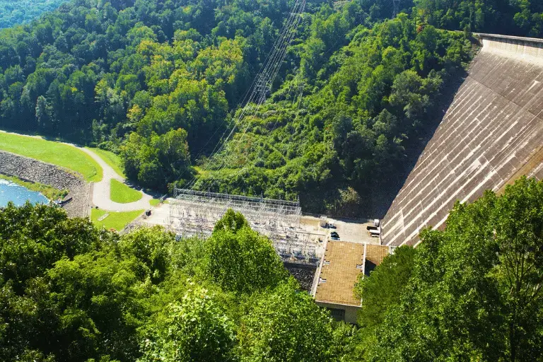
Rising 480 feet, Fontana Dam is the highest dam in the Eastern United States.
Wander across its 2,365-foot span and savor expansive vistas of the 17-mile-long Fontana Lake and the neighboring Great Smoky Mountains.
The tourist center offers thorough details on the dam building during World War II and its function in the regional electricity supply.
Plan properly since the region can be crowded, particularly during major travel seasons.

A historic fire tower with outstanding views of Fontana Lake and the Great Smoky Mountains, the Shuckstack Tower rises to a height of sixty feet; the tower offers a distinctive perspective to view the surrounding wildness.
About a 7-mile round trek, the climb to the tower is rewarded with a breathtaking landscape and significance in history.
The tower is old and somewhat unstable; hence, use great care while climbing.
Among the most famous viewpoints in the Great Smoky Mountains, Rocky Top presents several. This peak, at 5,441 feet, offers breathtaking views of the nearby mountains and valleys, so it is ideal for stunning images and enjoying the natural beauty.
About 13 13-mile round walk, the climb to Rocky Top winds across open meadows and lovely forest.
The trail is steep and challenging, so be prepared with plenty of water and proper hiking gear.
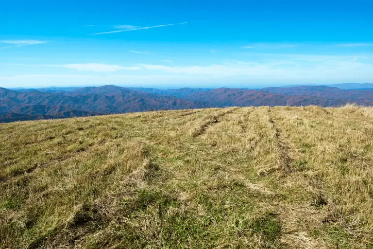
Rising 4,629 feet, Max Patch is a big, grassy bald with 360-degree vistas of the Appalachian Mountains around.
Renowned for its breathtaking sunrises and sunsets, this location is a favorite with photographers and environmentalists. Because of its broad, unbroken sky, the region is also perfect for picnicking and star viewing.
Dress in layers and pack a windbreaker since the temperature can be cool and windy.

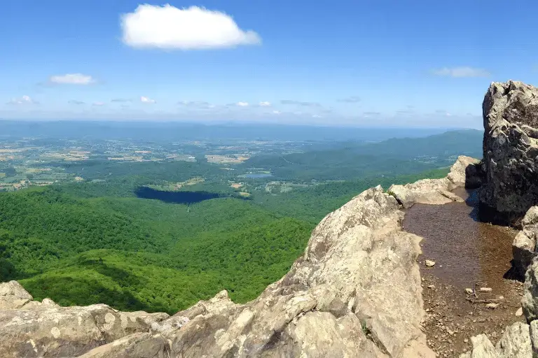
Standing at 5,516 feet, Big Bald gives amazing sweeping vistas of Tennessee and North Carolina.
The barren top offers a clear, grassy space ideal for rest and appreciation of the surroundings. Fall, when the foliage changes colors, this area is very lovely.
At this level, the weather might be erratic; hence, be ready with suitable gear and clothes.

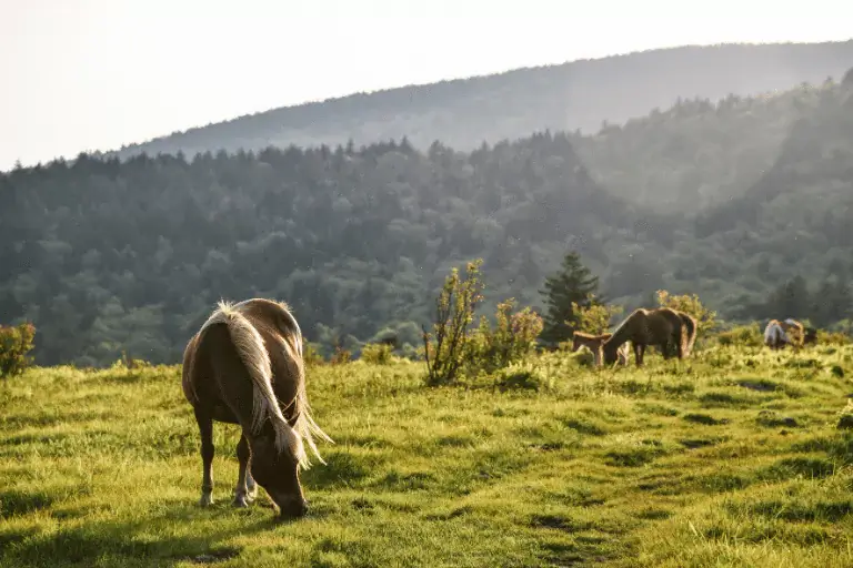
Rising at 5,807 feet, Jane Bald, a member of the picturesque Roan Highland, provides amazing views of the nearby mountains and valleys.
This area is especially well-known for its vivid June rhododendron blossoms, which draw plenty of hikers and photographers.
About 4.5 miles round trip, the path to Jane Bald winds past other picturesque locations, including Round Bald and Grassy Ridge.
The terrain may be steep and rough; hence, pack lots of water and use strong hiking shoes.
Rising to 5,587 feet, Big Hump Mountain has broad vistas of the Appalachian Mountains and verdant valleys.
Renowned for its wide-open areas and natural beauty, this bald summit is the showpiece of the Roan Highland. About five miles round trip, the climb to Big Hump Mountain winds across gorgeous meadows and forested territory.
The trail can be challenging, with steep sections, so be sure to wear proper hiking boots and carry enough water and snacks.

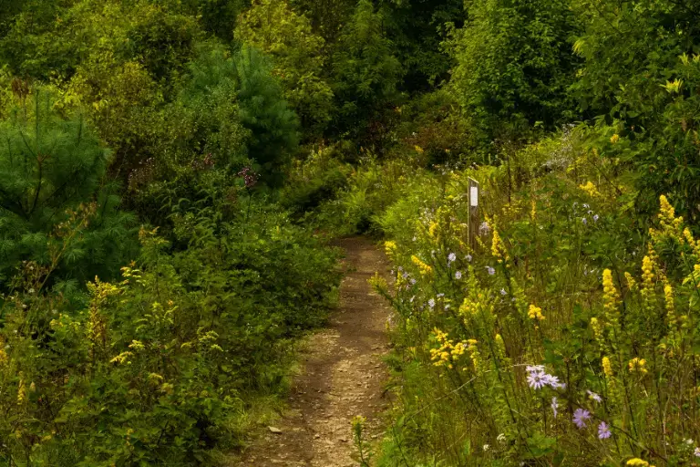
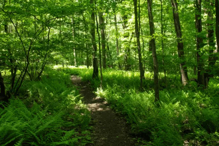
With stunning views of the surrounding valleys and woodlands, Sugar Run Mountain presents a quiet, less-traveled hiking experience.
The mountain is well-known for its calm surroundings and lovely woodland scene. The modest climb to the summit offers a chance to take in the natural splendor free from significant foot traffic.
The trail can be remote and less maintained, so ensure you have a map and adequate supplies.
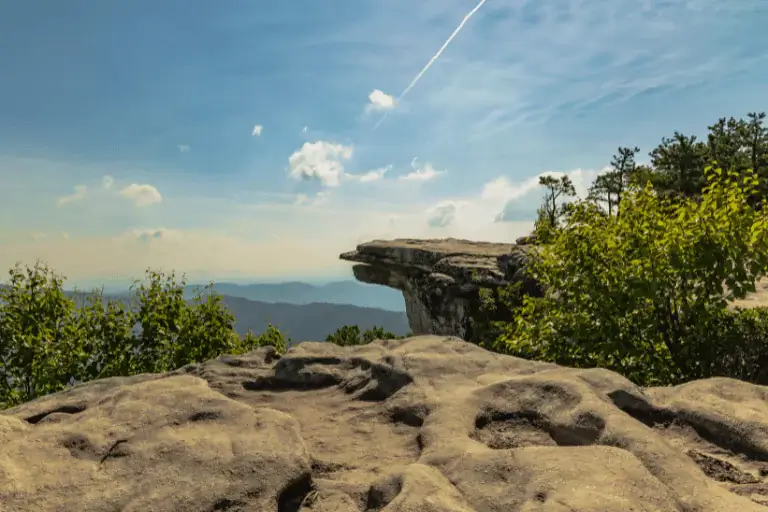
Thanks to its amazing 270-degree panoramic views of the Catawba Valley and surrounding mountains, McAfee Knob is among the most photographed areas on the Appalachian Trail.
The dramatic rock ledge just provides a great spot for unique pictures. About 8 miles round trip, the climb to McAfee Knob is well-marked and relatively difficult.
Start early to guarantee a parking spot and avoid crowds on the sometimes overcrowded trail, especially on weekends.
Peaceful and beautiful views of the large reservoir tucked among undulating hills and deep woodlands are offered from Carvin Cove Reservoir Overlook.
It’s a perfect place for relaxing and relishing the natural surroundings. Most hikers would find the modest difficulty of the climb to the overlook appropriate.
After rain, the trail can be muddy, so choose suitable shoes.
From its rugged outcrop, Raven Rocks affords amazing vistas of the Shenandoah Valley and neighboring mountains.
Hikers find great satisfaction in the 5.5-mile round-trip climb, sometimes referred to as the “Roller Coaster” because of its many ascents and descents. Fall foliage season brings especially breathtaking views from the top.
The path may be rocky and demanding; hence, pack lots of water and wear strong hiking boots.

With an elevation of 3,284 feet, Bromley Mountain provides breathtaking views from its peak, which also serves as a ski resort during the winter months.
During the warmer months of summer and fall, the expansive slopes offer breathtaking vistas of the surrounding mountains and beyond.
A moderately difficult ascent of around 6 miles is required to reach the peak.
The area is windy and cool, so dress in layers and be prepared for changing weather conditions.

You may get a bird’s-eye perspective of the environment and the nearby Manchester-Boston Regional Airport from Airport Lookout.
With the surrounding hills and woodlands serving as a picturesque backdrop, this location is ideal for watching planes take off and land.
The ascent to the overlook is manageable and takes only a few minutes, so it’s perfect for a leisurely day trip.
For a more serene experience, try visiting at off-peak hours, as the area tends to be bustling with visitors.
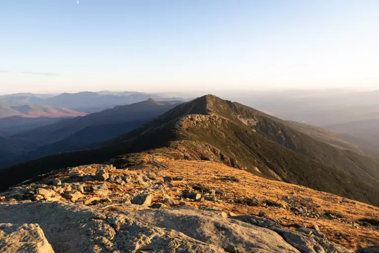
The Appalachian Trail’s Franconia Ridge offers stunning vistas of the White Mountains and is both a tough and scenic portion of the trail.
Little Haystack, Mount Lincoln, and Mount Lafayette are among the peaks that the 9-mile round hike—also known as the Franconia Ridge round—passes by. A must-see for its breathtaking alpine scenery and expansive views.
Be sure to bring the right gear and check the forecast before setting out on your hike, as the weather on the ridge can be vigorous and changeable.
At 6,288 feet, Mt. Washington is the tallest peak in the Northeastern United States. Hiking up this hard mountain gives breathtaking vistas. From its peak, you can see for miles, including the Presidential Range.
Its severe weather is another reason for its notoriety; a land speed of 231 mph was the highest recorded.
Extremely harsh and unwelcome weather is possible, so bring appropriate gear and be prepared for sudden changes.
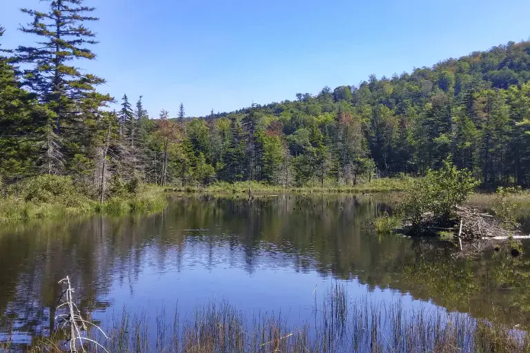
Enjoy peaceful and picturesque views of Long Pond, a beautiful lake encircled by lush woodlands. With plenty of room to swim, fish, and take in the scenery,
it’s the perfect place for a relaxing getaway. Away from the busier parts of the path, this area is tranquil and perfect for animal viewing.
Be certain you bring everything you need and let someone know where you’re going because the location might be somewhat secluded.

At 4,120 feet, Saddleback Mountain provides Mesmerizing outlooks of the neighboring mountains and Rangeley Lakes.
An exhilarating sense of achievement and Impressive views await you at the top of the mountain, which is reached after a strenuous trek.
During the fall foliage season, this peak takes on an even more picturesque appearance.
Don a good pair of hiking boots and stock up on water and snacks; the path is rough and steep at times.

Views of the mountains and woodland shoreline from Flagstaff Lake are vast and beautiful.
Thanks to its picturesque setting and serene waters, it is an ideal location for water sports, which include kayaking, canoeing, and fishing.
As a bonus, there are many beachside campsites in the region, making it an ideal spot for extended excursions.
Be sure to carry insect repellant and the right camping gear, as mosquitoes can be rather prevalent, particularly during the summer.

An ideal location for photographing sunrises and sunsets
Barren Ledges also boasts breathtaking panoramic views of the neighboring forest. Set in Maine’s 100-mile Wilderness, this region is famous for its solitary charm and untamed splendor.
Hikers are rewarded with stunning sights on the moderately hard walk to Barren Ledges.
Put on your hiking boots of choice because the terrain is rough and steep, and pack for any weather you might encounter.
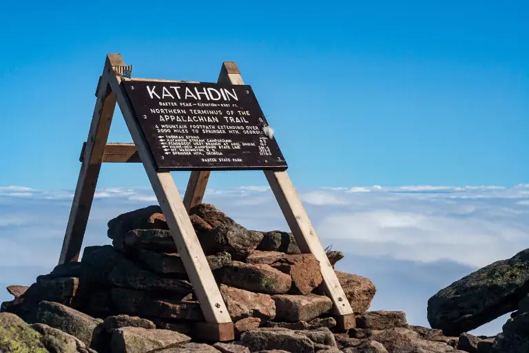
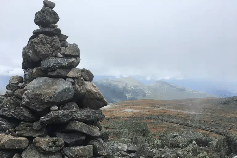
The northern terminus of the Appalachian Trail and the highest point on Mount Katahdin, Baxter Peak, rises at 5,268 feet.
As a major milestone for thru-hikers, it provides Majestic landscapes of the surrounding forest in all directions.
An exciting and satisfying ascent to the peak is possible via the difficult but well-known Knife Edge track.
Due to the exposed and challenging nature of the terrain, hikers should pack appropriately, have plenty of water, and be ready for unexpected weather changes.
In late April, when the rhododendrons are in full flower, the expansive views of the valleys and mountains beyond are at their most picturesque.
A wide variety of routes, some of which go directly to the Appalachian Trail, make this an ideal location for hikes of all lengths.
Be sure to pack layers in case the weather takes a turn for the worse.
One of the best places to go hiking in Pennsylvania is up The Pinnacle, a rocky outcrop that offers breathtaking views of the Lehigh Valley.
On the 8.7-mile round-trip trek to The Pinnacle, you’ll encounter both woodland pathways and open views.
It’s a popular destination for hikers who are looking for a challenging trek with stunning views.
Wear strong hiking boots and bring lots of water because the path is tough and uphill at times.
At the peak of Bear Mountain, you will get Awe-inspiring views of the Hudson Valley and its environs.
A portion of the ancient Appalachian Trail is present on the well-kept path that ascends Bear Mountain.
Perkins Memorial Drive and a picturesque stone lookout tower are both accessible from the peak.
Get there early to obtain parking and beat the crowds—the route gets very busy on weekends.
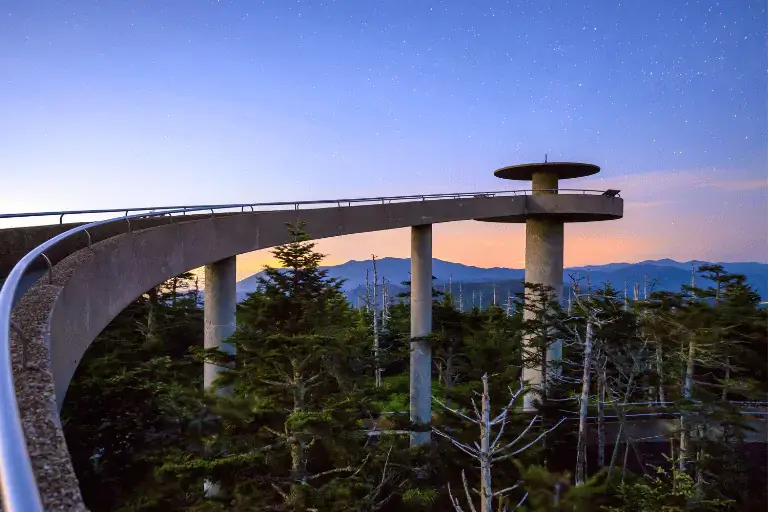
At 6,643 feet, Clingmans Dome is the Appalachian Trail’s highest point, and its observation tower provides stunning vistas in every direction.
The paved half-mile ascent to the peak offers Glorious sights of the Great Smoky Mountains and is both short and steep.
In addition to its varied flora, the region is famous for its unusual high-elevation environment.
Dress in layers and be ready for fast temperature fluctuations because the weather is substantially cooler and windier at the summit.